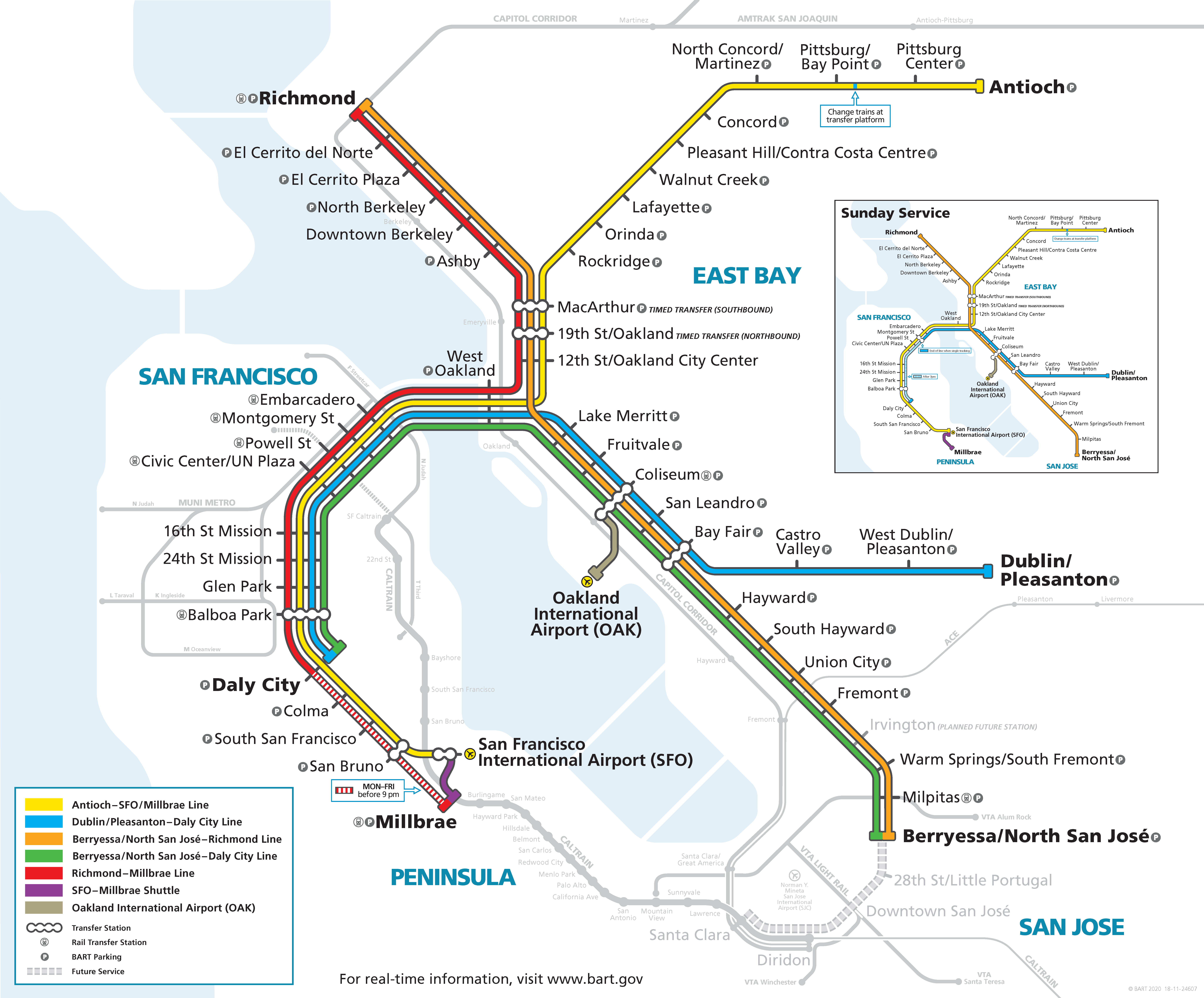
BART unveils system map for future Milpitas and Berryessa service
BART staff has finalized the next version of the BART system map that will be released once service to Milpitas and Berryessa begins. A date has not yet been announced and the project continues to prepare for revenue service.
The extension required rescaling to create the space needed to add South Bay details in preparation for the two new stations. Multiple improvements were made to the design to make it easier to read and to better highlight regional transit connectivity points. The map also shows the planned Phase II extension into Downtown San Jose and Santa Clara and the planned Irvington future station.
Since its opening in 1972, BART has seen numerous iterations of the system map to reflect the expansion of its system and the ever-evolving Bay Area public transit partner agencies.
(For more insight into the history of the BART system map, please check out our podcast episode with BART's map designer, Bart Wright.)
Here is the current BART system map:

Here is the finalized new BART system map:

Map improvements include:
- New regional rail icon to show connections to other rail systems, listed before parking icon
- New transfer open bubble symbol to emphasize ease of changing trains to a different line at the same station
- BART to OAK transfer is now consistent with other transfers in the system
- The Yellow line is smoothed out making it less crowded and easier to read
- Improved spacing between Oakland stations making it less crowded
- Improved Muni Metro and added details to better show Mission Bay
- Added South Bay details and emphasized VTA and other connections
- Added the Altamont Corridor Express
- Changed and varied rail line widths based on level of service
- Added Irvington Station as a planned future station
- Interlined the yellow line with the purple line to eliminate some annotations currently causing confusion
- Smoothed out the water lines for less distraction
- Removed arbitrary town names without a rail station to declutter the map