Search Results
Alerts and Advisories
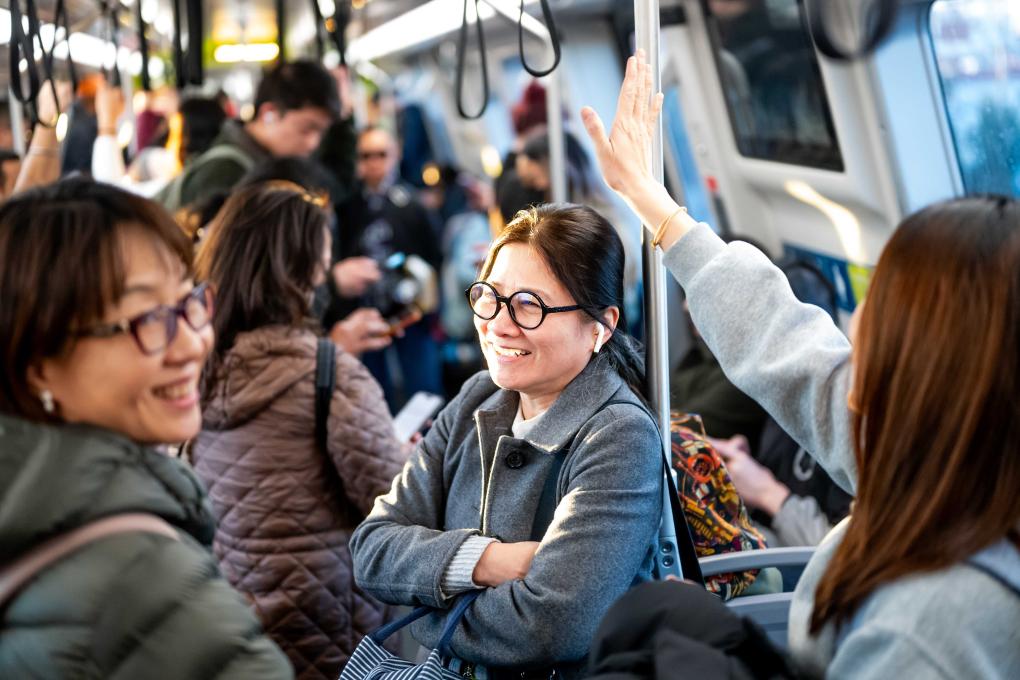
May 2026 posts highest weekday average since pandemic
More ridership news: A coordinated network of VTA, BART, and Caltrain, transported more than 37,000 passengers to and from the opening FIFA World Cup match between Qatar and Switzerland, setting a new ridership record for a major event at San Francisco Bay Area Stadium (Levi's Stadium). The success was made possible through close coordination among the Bay Area's transit agencies. BART transported passengers from San Francisco and the East Bay to Milpitas Transit Center, where they connected to VTA light rail service for the final trip to the stadium. Read more.
Whether it's a concert, festival, sporting event, parade, or now the FIFA World Cup, BART continues to be the Bay Area's transportation backbone for the region's biggest happenings.
May 2026 ridership was 12% above May 2025, continuing a strong growth trend across the system. Average weekday ridership reached 202,650 trips, the highest monthly weekday average since the pandemic.
Average Sunday ridership in May was 18% higher than April, driven by major events including Bay to Breakers, Carnaval San Francisco, multiple BTS concerts at Stanford Stadium, and a busy calendar of Giants, Valkyries, Roots, and Ballers games. On Bay to Breakers weekend alone, exits at Embarcadero and Montgomery stations surged as tens of thousands of participants and spectators used BART to travel to and from the event.
Growth was widespread across the system. Nearly every station recorded double-digit gains compared to last year, with some of the strongest increases occurring at SFO, South San Francisco, **Berryessa/North San Jose, Milpitas, and Antioch stations.
The positive ridership trends come as the Bay Area hosts major events this year. FIFA World Cup activities have now begun across the region, with BART and transit partners playing a critical role in moving fans to matches, watch parties, and other events as it did for the Super Bowl in February.
Ridership continues to move in the right direction, but growth alone is not enough to close BART's structural funding gap. The Bay Area's high rates of remote and hybrid work have fundamentally changed travel patterns, reducing the fare revenue that historically funded a large share of BART operations. BART has already implemented hundreds of millions of dollars in cost-saving measures while preserving service, but long-term financial stability will require additional operating funding alongside continued ridership growth.
Find more insights on May ridership in the monthly ridership snapshot. Learn more about BART’s finances at bart.gov/financials.
Service restored between Antioch and North Concord following earlier outside vehicle on the trackway
7:40 am UPDATE
Full service restored between Antioch and North Concord/Martinez after vehicle crash.
7:25 am UPDATE
Track inspections underway in anticipation of full service restoration shortly.
7:10 am UPDATE
Vehicle has been lifted from the trackway. And crews are making the repairs to the third rail cover-board and fencing.
We are hoping to open at least one trackway in about 30 minutes.
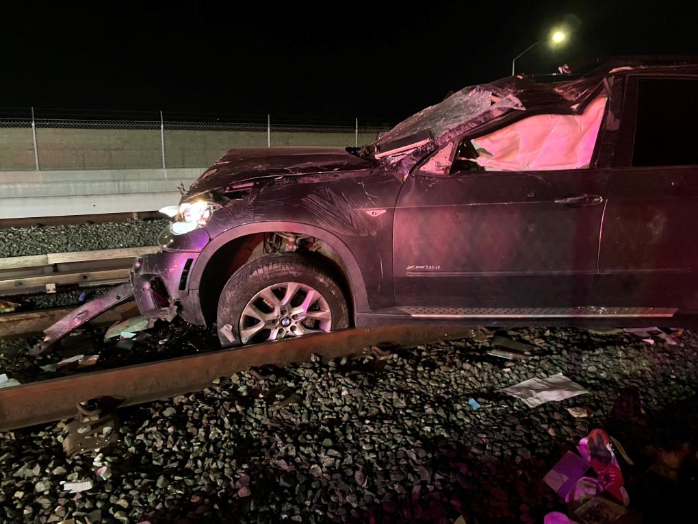
At around 3:45am a vehicle crashed through barriers and entered the BART trackway about 100 feet south of the Pittsburg/Bay Point BART Station. First responders arrived and reported to BART that the person in the vehicle was deceased.
The vehicle is on the BART trackway blocking both sets of tracks and significant damaged to BART’s third rail and track infrastructure occurred and will need repairs once the car is moved out of the way.
BART will begin morning service with no train service from Antioch to North Concord. Passengers should go to North Concord to catch a BART train.
Antioch Station will not have service to Pittsburg/Bay Point, but the DMU train will take local riders from Antioch to Pittsburg Center.
Bus Info:
As of 5am there is one Tri Delta Transit bus from Antioch to Pittsburg Center to Pittsburg Bay/Point and there are two County Connection buses between Pittsburg/Bay Point and North Concord. We are working with partner bus agencies to get more buses at Antioch and Pittsburg Bay Point to connect East Contra Costa riders to North Concord.
Extra staff are at impacted stations.
The CHP is leading the vehicle investigation and BART crews are on standby to perform track work.
Special late-night service added for Beyoncé Renaissance Tour on 8/30/23
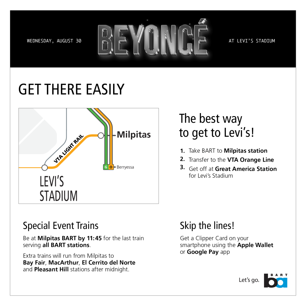
BART will run extra trains and offer special limited service after midnight for the Beyoncé Renaissance World Tour at Levi’s Stadium on Wednesday, August 30, 2023.
Getting to Levi’s Stadium using transit is easy. Fans will transfer from BART at Milpitas Station to VTA’s Orange Line and ride to VTA’s Great America Station, located on the North side of Levi’s Stadium.
BART will have extra security and station staff to help people get around.
What You Need to Know About the Ride Home
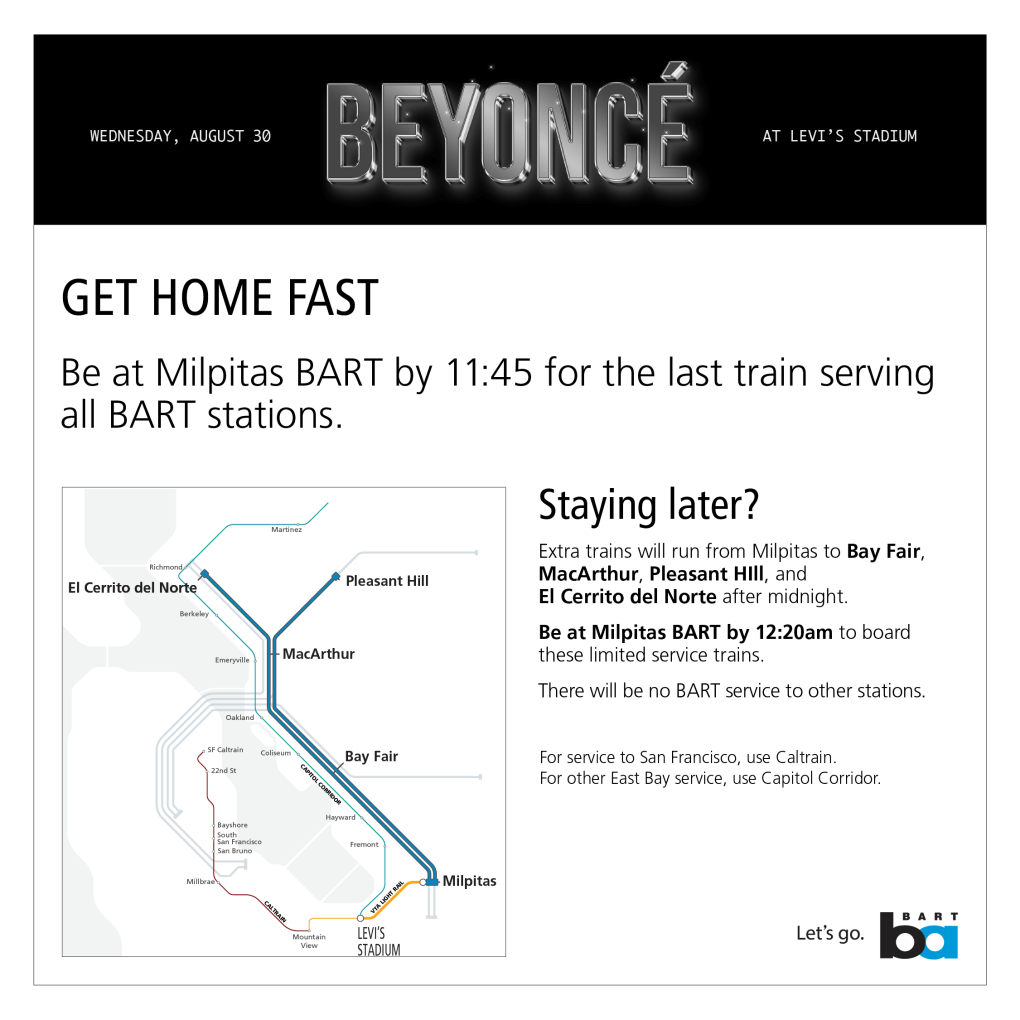
BART will run its normal last train of the evening leaving Milpitas at 11:51pm, making all regular stops. This is the last train that will get you to all BART stations in the system.
BART will run two special event service limited-stop trains that will depart Milpitas Station at around 12:30am serving limited stops after regular BART service ends.
The late-night limited service will pick up riders at Milpitas Station with stops only at the following East Bay stations, the train will skip all other stations without stopping:
- Bay Fair
- MacArthur
- Pleasant Hill
- El Cerrito del Norte
| Station | Special Event Limited Stop Trains |
| Milpitas | Departs at 12:30am and 12:35am |
| Bay Fair | Arrives at 1:06am and 1:11am |
| MacArthur | Arrives at 1:27am and 1:32am |
| El Cerrito del Norte | Arrives at 1:42am |
| Pleasant Hill | Arrives at 1:46am |
These four East Bay stations have large parking lots located near the freeway. Riders who know they want to stay until the very end of the show, should park their cars or arrange pick-up at one of these four stations. Use the timetable above to share your pick-up time.
These special limited stop trains will be labeled “Limited Stop to El Cerrito” and “Limited Stop to Pleasant Hill.”
Other Transit Options
Riders coming from San Francisco should take Caltrain home or ensure they take the 11:51pm BART train home. Caltrain is providing one extra local train from Mountain View to San Francisco 75 minutes after the show ends or when the train is full. BART is not keeping any San Francisco stations open beyond normal closing hours due to the lack of parking lots at SF stations and because Caltrain is providing this special service.
Capitol Corridor is also offering special train service that departs at 11:59pm from their Great America (GAC) station. Capitol Corridor has stops next to BART's Coliseum and Richmond stations.
Other Tips
Parking is free after 3pm at BART stations.
Before you leave home put a Clipper card on your cellphone through either Apple Pay or Google Pay. Clipper is waiving the $3 new-card fee for riders who add either of the mobile options. Please ensure you have sufficient funds for a round trip. Plan at the cost of your trip in advance.
Installation work to begin October 28 for Next Generation Fare Gates at Montgomery Station
On October 28, BART will begin the installation Next Generation Fare Gates on the concourse level of Montgomery Station. The installation work will happen in stages so riders can continue to use the remaining current gates while new ones are installed. There will be additional BART staff as well as signage to direct riders to the open gates. Installing each new array is expected to take up to two weeks to complete. BART will eventually replace all seven fare gate arrays at Montgomery. The work is expected to continue into December.
A temporary barrier will be installed to provide a safe workspace for the installation team as well as to protect riders from construction. The work will not impact train service, but riders may experience a few extra minutes wait to pass through the fare gates during peak travel hours.
The latest work comes after BART has successfully installed Next Generation Fare Gates at eight other stations across the system. All 50 BART stations will have new fare gates by the end of 2025. You can learn more about BART’s Next Generation Fare Gate project here. Riders can provide feedback about the new gates at bart.gov/comments.

Around the Bay this Weekend: All Aboard Transit Day, special trains for A’s/Ed Sheeran, BARTable ways to observe Hispanic Heritage Month and Rosh Hashanah
Friday, Sept. 15 – We have some huge news to share: This week we’ve seen some of the highest ridership days since the start of the pandemic. On Wednesday, we hit a major milestone – the highest ridership day since spring 2020 with 192,961 rides! Tuesday followed close behind with 192,081 rides. The numbers don’t lie – riders are coming back to BART.
If it’s been a bit since you’ve been aboard, you’ll notice some changes in our system: cleaner trains and stations, additional safety presence walking trains, and a newly reimagined schedule that increases service on weeknights and weekends. Read BART’s new Safe and Clean Plan here.
On Sunday, we greeted another milestone; we said an informal farewell to our legacy trains as our new, Fleet of the Future trains take up the helm for our base schedule (you may see some legacy trains for extra event trains and emergency contingencies). If you didn’t get to a station on Sunday to wave goodbye to the last scheduled legacy train, don’t fret! We’ll hold a proper retirement ceremony in the future, likely next year.
Speaking of celebrations, this weekend marks the start of two holidays: Hispanic Heritage Month (Sept. 15 to Oct. 15) – a celebration of the contributions, histories, and cultures of Hispanic Americans – and Rosh Hashanah (Sept. 15 to 17), the Jewish New Year and start of the High Holy Days. Read BARTable’s articles on local ways to observe the holidays here and here.
The regional celebration of public transportation – Transit Month – is still fast underway as well. To learn more about two exciting events this weekend – All Aboard Transit Day and Meet the BART Anime Mascots – keep scrolling.
We’ve also scheduled special service and event trains for two big events this weekend – the Ed Sheeran concert and the Oakland A’s vs. Padres. Find more info below.
For an in-depth listing of local events, visit the BARTable website. We publish a weekly event roundup, BARTable This Weekend, that highlights happenings around the region as well as cool contests and sweepstakes from our partners.
Saturday, Sept. 16: Special late-night service added for Ed Sheeran concert
BART will run extra trains and offer special limited service after midnight for the Ed Sheeran concert at Levi’s Stadium on Saturday, Sept. 16, 2023.
Getting to Levi’s Stadium using transit is easy. Fans will transfer from BART at Milpitas Station to VTA’s Orange Line and ride to VTA’s Great America Station, located on the north side of Levi’s Stadium.
BART will have extra security and station staff to help people get around. Learn what you need to know to get home and read our traveling tips here.


Friday, Saturday, and Sunday, Sept. 15, 16, and 17: Special event trains for Oakland Athletics vs. San Diego Padres at Oakland Coliseum
The Oakland A’s face rivals the San Diego Padres on Friday (6:40pm), Saturday (1:07pm), and Sunday (1:07pm) at the Coliseum. We’re expecting many riders to take BART, so we’ve added special event trains on Friday and Saturday to get fans home from the games.
The Friday game honors Roberto Clemente Day and will include a Latin Music Fireworks Show. The Saturday game will celebrate Latin and Hispanic Heritage Day, and Sunday will honor Make-A-Wish children and families.
Saturday, Sept. 16: All Aboard Transit Day and Meet the BART Anime Mascots at Powell Street
This Saturday, Sept. 16, is All Aboard Transit Day. On this day, we encourage people to take as many trips as their hearts desire to help us beat the September 2022 ridership record, which recorded 500,000 rides across all agencies! We'll total up the ridership numbers and report to the public if we exceed our previous record. Your rides on Saturday can be logged for the Transit Month Ride Contest, too.
Also on Saturday, Sept. 16, is our "Meet the BART Anime Mascots" event at Powell Street Station from 2pm to 6pm. Take photos with the mascots, make buttons with staff, grab a prize from the BART capsule ball machine, and more! Come in cosplay and get a rare BART anime charm. The Link21 outreach team will also table to talk about the project to build a second train crossing connecting Oakland and San Francisco.
Weekend Read: BART Board President and General Manager speak with Manny Yekutiel aboard moving train about future of Bay Area transit
On Friday, Sept. 8, around 65 people gathered in the concourse of 16th Street Mission Station to welcome their weekends aboard a BART train.
They were there to catch an evening train aboard which Manny Yekutiel, the owner of the San Francisco café Manny’s, would host a conversation with BART Board President Janice Li and General Manager Bob Powers about the future of Bay Area public transit. The gathering was a unique opportunity for BART leaders to hear directly from riders, and riders to hear from them. The ethos of the event: Why not hold such a conversation on the very trains in question?
Hear more from Manny, Li, and Powers -- as well as the riders who attended -- here.
Sweepstakes Spotlight: Win Tickets to See Manhattan Transfer at SFJAZZ
With the SFJAZZ season now upon us, enter to win tickets for you and your guest to see Manhattan Transfer on Friday, Sept. 29 at 7:30pm. The Manhattan Transfer has kept the vocalese flame burning brightly for half a century. They will bring the curtain down on a monumental career with these performances at the SFJAZZ Center on Sep 29 and 30, as part of their final tour.
Click here to enter the sweepstakes by Monday, Sept. 18.
Happy Riding this Weekend!
We hope you enjoy your weekend adventures aboard our trains.
Stay in touch by signing up for the BARTable This Weekend newsletter on the BARTable website – your one-stop shop for all things accessible by BART. You can also keep up with BARTable on Facebook and Instagram.
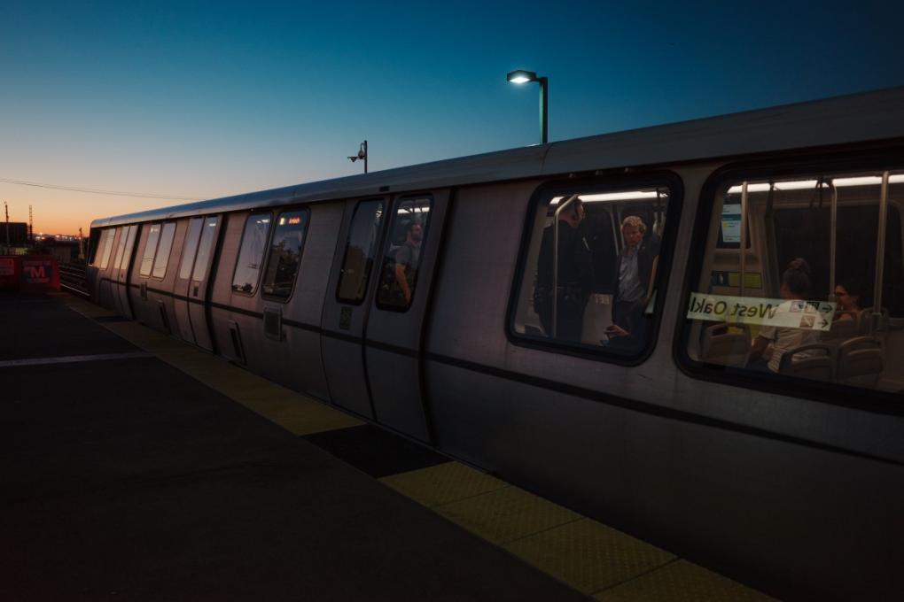
BART General Manager Bob Powers pictured through a train window at West Oakland Station as the train made its way back to the East Bay following a conversation with Manny Yekutiel, BART Board President Janice Li, and Powers on Friday, Sept. 8, 2023. Photo by Evan Dorsky.
Lake Merritt TOD construction begins in 2024; parking changes start June 1
August 14, 2024 Update
Starting September 16, 2024, our exciting project to develop the land around Lake Merritt Station to include affordable and market-rate housing, offices, and retail space will officially begin. To accommodate this Transit-Oriented Development (TOD) project, the parking lot will be permanently closed starting September 16, 2024. Partial closures will start September 1, and the last day to use the Lake Merritt parking lot is September 15, 2024.
The lot is available for Daily Fee parking on a first-come, first-served basis until September 15. Daily Fee parking payment is required Monday-Friday, 4am-3pm, except on BART holidays. Pay for Daily Fee parking with the BART Official App or remember your stall number and pay inside the station via cash, credit, or debit.
Reserved parking is available at Fruitvale Station, MacArthur Station and many other BART locations with parking.
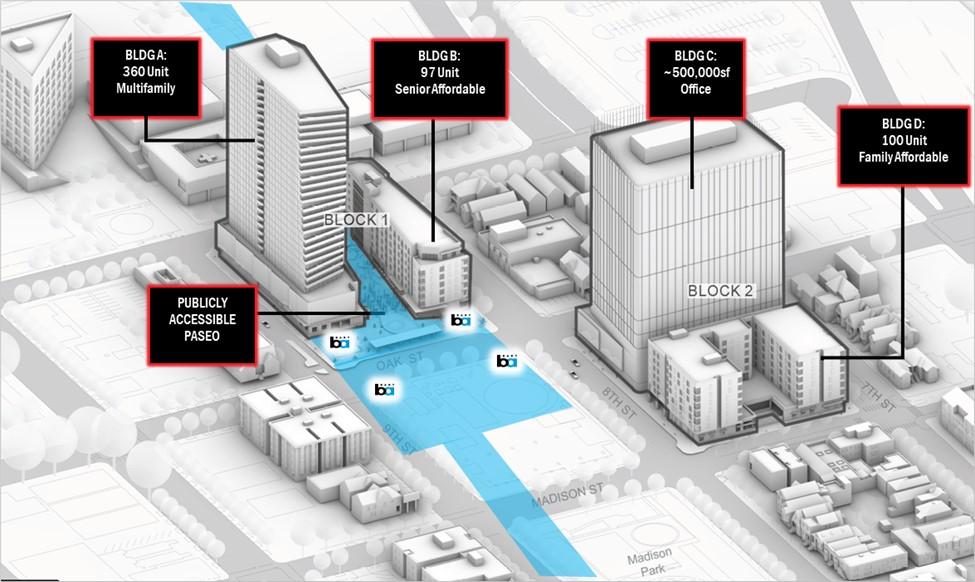
Starting in 2024, the area around the Lake Merritt BART station will begin to be developed. New affordable and market-rate housing, office, and retail space will be developed over several phases. Phase 1.1 (Bldg. B on the illustration) is currently scheduled to break ground in mid-2024, with the construction of a 97-unit senior affordable housing building on BART’s existing surface parking lot.
To accommodate this Transit-Oriented Development (TOD) project, BART will no longer offer Reserved Parking starting June 1. Daily Fee parking will still be available on a first-come, first-served basis until construction formally begins, when the parking lot will be permanently closed. Customers can check bart.gov/parking for updates on Daily Fee parking availability, as well as signage at the two entrances to the Lake Merritt parking lot.
Lake Merritt Station is easily accessible by bicycle and transit. Reserved parking, including Monthly, is available at Fruitvale Station, MacArthur Station, and many other BART locations with parking.
For more information about the TOD project, visit: bart.gov/about/business/tod/lakemerritt
*This article was originally posted on March 21, 2024
Lafayette Station: Town Center pathway and bike station construction
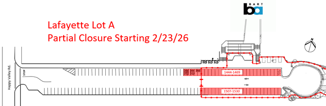
On Monday, February 23rd, construction will begin on the Lafayette Town Center Pathway and BART Bike Station project. Portions of the reserved parking area south of the Lafayette BART Station (lot A) will close beginning on February 23rd for construction of the Lafayette Town Center Pathway and BART Bike Station project. About 50 reserved parking spaces will close during construction, leaving about 70 available in Lot A.
Access to Lot A from Happy Valley Road will remain unchanged, and pedestrian/bicycle access will be maintained through or around the site during construction from both ends of the lot.
The project, expected to be completed this summer, will result in a new unattended BART Bike Station, providing secure parking for up to 82 bicycles and improved shared-use bicycle and pedestrian pathway connecting the south side of the Lafayette BART station and Mount Diablo Boulevard. Also included is a new plaza between the shared-use pathway and the BART entrance and a new passenger vehicle turnaround featuring a suspended public art installation.
The project will repurpose 19 parking spaces in the eastern end of Lot A for the new passenger vehicle turnaround and plaza. It is a joint project between BART and the City of Lafayette, with the City leading construction of all components.
The project also includes drainage improvements, grading and paving (including decorative pavers and colored pavement treatments), plantings and irrigation, lighting, signage, pavement markings and bollards.
Total project cost is estimated at $3.2M, with funding coming primarily from a mixture of Contra Costa County Measure J transportation sales tax revenue provided by the Contra Costa County Transportation Authority, and BART Measure RR funds. Learn more about the project by visiting the City of Lafayette’s project web page.
Huge bicycle and pedestrian improvements at North Berkeley Station
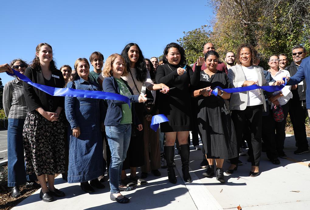
BART has successfully completed a transformation of North Berkeley Station that will make it easier for more people to walk and bike to the station. The work also sets the stage for the future transit-oriented development (TOD) project at North Berkeley, which will bring hundreds of affordable homes to the community.
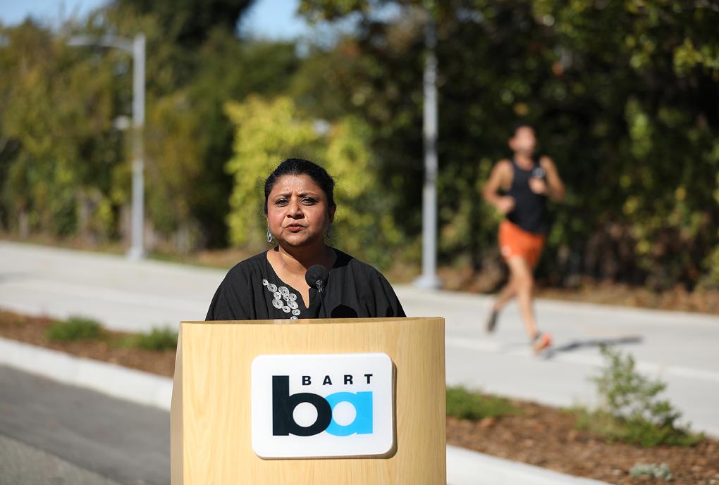
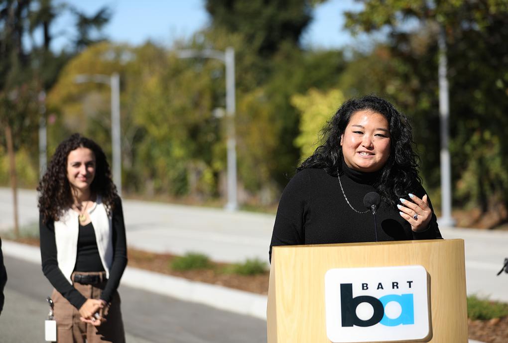
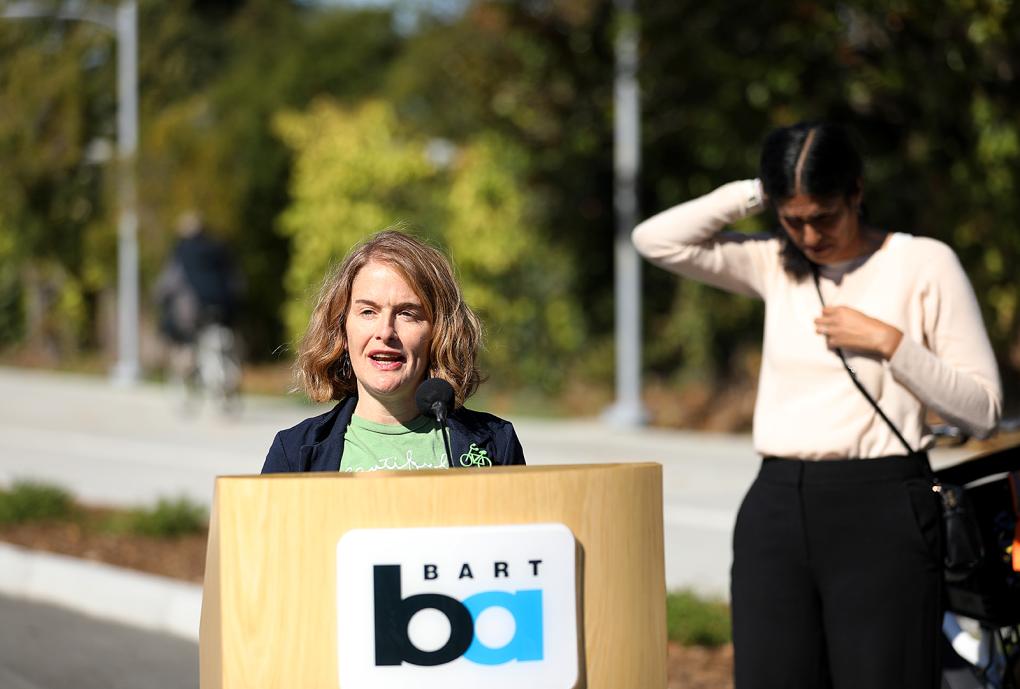
"As Mayor of Berkeley, I was a staunch supporter of projects like these North Berkeley bicycle and pedestrian access improvements that allow people to access BART safely utilizing active transportation modes,” said District 7 State Senator Jesse Arreguin. “As Senator, I am proud that the state supports sustainable transportation projects, in this case with $3.4 million from the Affordable Housing and Sustainable Communities program.”
“I’m thrilled to see the completion of the North Berkeley Bicycle and Pedestrian Access Project,” said BART Director Barnali Ghosh. “These improvements make it safer and easier for people to walk, bike, and connect to BART. Delivering these community benefits years before the first North Berkeley TOD building opens reflects BART’s strong and lasting commitment to North Berkeley.”
Key upgrades at North Berkeley BART Station include:
- The widening of the Ohlone Greenway between the Acton Street/Virginia Street intersection and Virginia Gardens.
- A new speed table (a raised section of road designed to slow down vehicles) and raised crosswalk in front of the station entrance.
- New two-way cycle tracks along the BART access roads.
- New bike lockers for larger cargo bikes.
- Installation of an ADA-compliant ramp linking Sacramento Street to the station elevator.
- Public space enhancements including new bollards, storm water management features, landscaping, and pedestrian-scale lighting.
“The North Berkeley access improvements are just the beginning,” said Berkeley Mayor Adena Ishii. “With more than 700 homes approved at North Berkeley BART and a similar number planned at Ashby, we’re showing that Berkeley can build more housing while making it easier for everyone to move safely and sustainably through our community.”
The improvements at North Berkeley have come as BART has worked closely with the City of Berkeley and a team of housing developers on the future transit-oriented development at the station. The TOD will complement the surrounding walkable residential neighborhood and nearby shopping corridor on University Avenue.
The development team, North Berkeley Housing Partners, is advancing a plan that includes about 750 homes, roughly half affordable to residents with lower incomes. The plan also calls for new public open space over the underground BART tracks, a childcare center, and about 6,500 feet in retail space. The City of Berkeley laid the foundation for the project with an extensive community engagement process. Work on the TOD is expected to begin in 2026.